Bay Area Air-quality Maps

Here are some links for finding information about air quality during the fires:

Search by city:
https://airnow.gov/

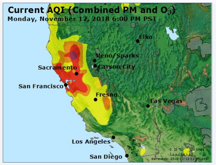
Current status and forecast maps:
https://cfpub.epa.gov/airnow/index.cfm?action=airnow.local_city&cityid=317
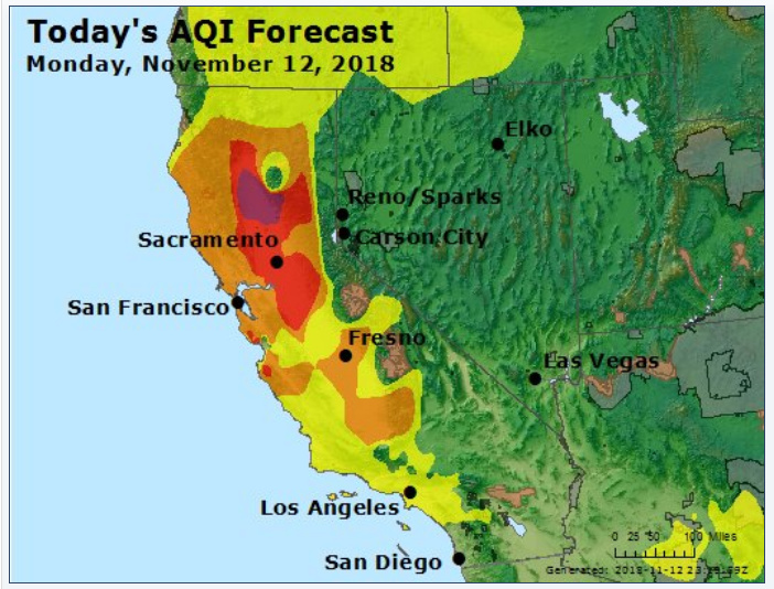
Forecast:

Another monitor – change the date in the URL to match the current date:
http://www.baaqmd.gov/about-air-quality/current-air-quality/air-monitoring-data?DataViewFormat=daily&DataView=aqi&StartDate=11/10/2018&ParameterId=316

I’ve been using this one this year
https://www.purpleair.com/map#10.01/37.8378/-122.2943

1 Like

Has anyone found anywhere to go where there isn’t smoke? I’ve been staying in a room with an air purifier and it’s still pretty bad. It looks like it would take hours to drive somewhere without smoke.

It looks like things might improve here tomorrow, but also spread across most of the state? This is the map for today about an hour ago:

I’m not sure if this is the forecast for tomorrow or the forecast for today: